


Rafael Becomes a Hurricane in the Caribbean, Set to Enter Gulf Waters
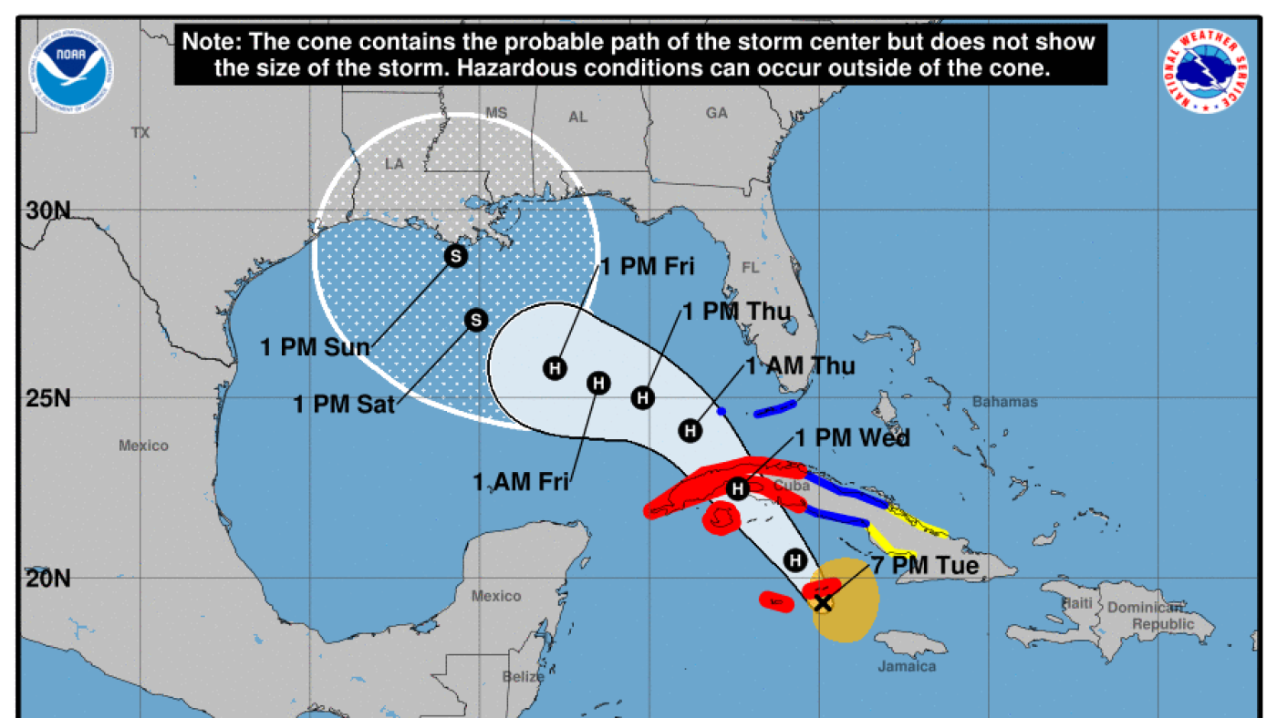
According to the National Hurricane Center, Hurricane Rafael has intensified, now gripping the Caribbean Sea with hurricane force as it edges closer to the Cayman Islands. Its current trajectory predicts a path over Cuba, subsequently making its way into the Gulf of Mexico.
As it powers through the southern stretches of the Caribbean, Rafael has gained strength, becoming a serious weather system.
This Category 1 hurricane features maximum wind speeds reaching 75 mph and is on a course towards the Cayman Islands. Expect its presence near or over Cuba's western region by Wednesday, transitioning into the Gulf by evening.
Forecasters are anticipating a 'rapid and steady intensification' as it advances over the following 24 hours.
Forecasts indicate heavy rainfalls likely from now until early Thursday in Jamaica, the Cayman Islands, and portions of Cuba. In elevated regions, isolated areas could see up to 10 inches of rain, posing risks of flash floods and landslides.
The Lower and Middle Florida Keys, including the Dry Tortugas, are under a tropical storm warning with rainfall amounts potentially reaching three inches. The outlook for tomorrow suggests ongoing rainfall over the Keys and parts of inland Southwest Florida.
Despite expectations for further strengthening, Rafael is likely to downgrade to a tropical storm upon entering the Gulf of Mexico, affected by wind shear and cooler water temperatures.
Experts warn against making premature assumptions about Rafael's potential impacts on the northern Gulf Coast, emphasizing that it's still unclear.
Leave a Reply