


Wildfire Detection Tools: Helpful But Not Infallible
On the morning of November 8, 2018, at 6:25 am, a report of a fire near Poe Dam in northern California was made to a 911 dispatcher. Nineteen minutes later, firefighters spotted what would become the infamous Camp Fire. Drought conditions had left the vegetation dry, and strong winds swept toward the town of Paradise, located 10 miles southeast. Fire chief Matt McKenzie warned that the situation had the potential to escalate dramatically.
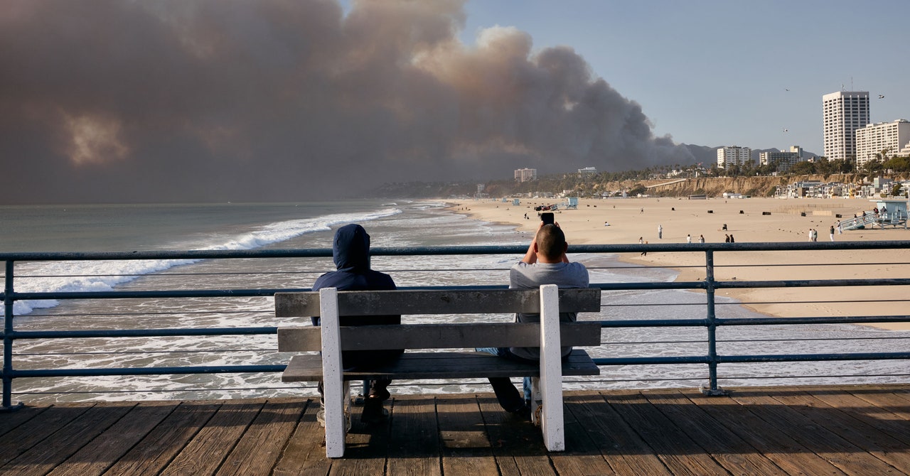
Just an hour after the initial call, embers were already igniting new fires on Paradise's south side, preempting the main blaze. In less than 40 minutes, the core of the fire reached the town. The Camp Fire raged for two weeks, devastating Paradise and claiming 85 lives. It's one of America's most costly fires alongside recent Los Angeles blazes.
The rapid and destructive nature of recent fires has shifted focus towards early detection. The aim is to identify fires as they start, allowing teams to extinguish them before they spiral out of control. Technologies like cameras, satellites, and sensors attached to trees are proposed solutions, yet experts stress the inherent limitations of these tools—acknowledging that some fires defy even immediate detection efforts.
Current Detection Systems
According to Marcus Hernandez, deputy chief at the California Department of Forestry and Fire Protection’s research and development division, 911 calls remain the primary method for fire detection. California Fire (Cal Fire) also employs AlertCalifornia, a system encompassing over 1,144 high-definition cameras capable of viewing up to 60 miles during daylight and 120 miles at night. These cameras are managed by experts stationed at state command centers.
In the middle of 2023, AlertCalifornia enriched its capabilities by incorporating AI technology to detect smoke columns automatically. Hernandez noted that while these strategically placed cameras were valuable even before the AI addition, this new feature significantly enhances anomaly detection.
Cal Fire utilizes FireGuard, a system using military satellites to pinpoint heat signatures indicative of wildfires. This setup triggers a series of checks using various tools to confirm fire presence, ensuring an immediate response.
Innovative Detection Approaches
Emerging from Germany, Dryad Networks aspires to elevate fire detection with tree-mounted sensors that react to wildfire smoke. Carsten Brinkschulte, CEO and cofounder, describes the device as a cost-effective, solar-powered gas sensor akin to a smart smoke detector, featuring AI and wireless capabilities.
Priced at about $104 each, these sensors can cover approximately one hectare of forest. Although California possesses vast forests, Dryad focuses on high-risk zones like those near infrastructure or recreational trails, often the starting points for human-induced fires. Notably, these areas include infrastructure like train lines and power routes linked to numerous fires since 1992, including the Camp Fire.
Brinkschulte admits the emphasis is on human-caused fires where urban meets wilderness. Their system, already trialed 50 times—primarily in southern Europe and once in California—is even being tested in South Africa to shield commercial forests from flames.
Challenges and Future Prospects
Yet Marcus Hernandez points out that these tree-mounted sensors haven't proven themselves at a wide scale, both in cost and reliability. Most notably, many sensors detected non-existent fires leading to numerous false alarms, and they faced difficulties in maintaining power and communication signals.
Beyond detection, comprehensive observation of fire dynamics is crucial. The Fire Urgency Estimator in Geostational Orbit (Fuego) project at UC Berkeley aims to keep real-time tabs on wildfire movements, potentially offering critical insights during an outbreak.
A popular app aggregates existing wildfire data for public use rather than for aiding fire crews. During the LA fires, the app drew 600,000 users overnight. However, it lacks the capability to gather new, actionable data.
Tim Ball and Carl Pennypacker’s proposition involves launching a dedicated satellite to continuously monitor wildfires in the western US. This satellite could spot small but dangerous spot fires far ahead of large fire fronts, providing early warnings for areas that have yet to be evacuated.
However, the Fuego project seeks financial backing to propel its development. Ball highlights the high costs of satellite launches and the challenge of securing collaborative funding through a public–private partnership.
The Inevitability of Wildfires
Ultimately, both Ball and Hernandez acknowledge the limits of early detection in halting all wildfires. The combination of factors like the strong Santa Ana winds, desiccated conditions, and abundant fuel during the Los Angeles fires, for example, created scenarios where early intervention couldn't have minimized the fires' spread.
Leave a Reply